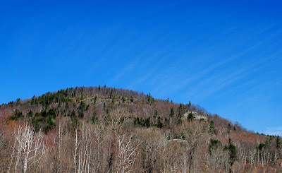
alive and well on the other side of the highway
“To those devoid of imagination a blank place on the map is a useless waste; to others, the most valuable part.” -Aldo Leopold, 1938
Tuesday, March 27, 2012
Monday, March 26, 2012
Critical Paths: A Closer Look At Wildlife Corridors
The following post will serve as an outline summary of the National Wildlife Federation's Critical Paths: Enhancing Road Permeability For Wildlife In Vermont. This report from August 2009 is one of the more valuable local resources regarding habitat connectivity, although it does not specifically analyze Interstate 89. In the context of our project's first goal to determine: 1) the effects of Interstate-89 as a barrier on wildlife habitat and movement patterns along the three mile border between Bolton and Duxbury and 2). what can be done to promote safe and efficient highway travel while maintaining ecological integrity and continuity of the Green Mountain habitat/corridor.
The Large Picture:
According to the report, in 2008, Vermont had 14,122 miles of public roadways. Interstate 89 holds claim to around 130 miles of that number. It doesn't seem like a lot. In fact, it's less than 0.01% of the total roadway in the state. But even the smallest number can have some of the most serious implications. With four continuous lanes and a path of travel that takes the highway through the Green Mountain corridor, I-89 falls short of only Interstate 91 which maneuvers north to south through the Connecticut River Valley regarding length x lanes.
The National Wildlife Federation has designated 124 crossing zones of the Green Mountain corridor in this report, eliminates 80 (because they run north to south and do not serve as an "intersection" so to speak), and does not include six of these zones which fall within Interstate 89. The report claims: "This is the single greatest fragmenting feature to north-south habitat connectivity in Vermont and potential solutions to this area will likely be complicated and expensive."
It is clear that we're up against some heavy challenges.
Concerning the Site:
The report also outlines the criteria used to evaluate crossing zones. GIS mapping is required in this stage of analysis and while the NWF does not include the I-89 site, another project developed by the state in cooperation with VTrans does (this project will be included in another post as a whole in the near future).
The criteria are as follows (listed from higher to lower importance):
Habitat Sustainability - Based off of housing density & core habitat, Rating 6-10 - Our site, according to the analysis from 2006, ranges close to zero (nearest the town of Bolton), up to values of 7.5-8 directly on the highway.
Conserved Lands - As previously mentioned, Mount Mansfield State Forest borders are under 3 miles to the northwest of the site and Camel's Hump State Park borders are within 0.5 miles to the south.
Wildlife Crossing Value - based off mortality rates, 5-10 - This value also varies along our site range. Where habitat ratings were low, mortality rates are highest in moose and bear. The lower the number, the more historically dangerous the crossing is, and surrounding Bolton, the values range from 5.5-6 for nearly a mile. Higher values of 9 occur towards the east end of the site, most likely due to the higher cliff surroundings that do not place wildlife at road level.
Road Kill - In the areas where crossing values are <6, 62.2% of all bear collisions and 70.1% of all moose collisions occur statewide. There are several recorded moralities of moose and bear mainly concentrated to the far west and east of our site range.
Effects of Interstate 89
Seasonal migration - The black bear, mentioned earlier as one of the more prominent subjects of this study, has high populations concentrated in Mount Mansfield State Forest. Management plans for this mammal in the protected areas to the north can be found here (another publication that will be considered in later posts). The black bear relies on seasonal habitat, and can be restricted in movement by highways such as I-89. The masting of beech stands in the summer and fall and den habitats for the winter require movement of the black bear that (as we have seen) can lead to high mortality rates.
Genetic Flow - One of the sole purposes of biological conservation is maintaining genetic variation and gene flow in order to minimize local extirpation. By reducing movement and limiting populations to certain areas of their habitat (regardless of high habitat sustainability values), humans run the risk of restricting necessary heritability and losing populations of species that do not exist in high numbers in the first place.
Road Mortality - As mentioned earlier, road mortality rates are high in certain sections of our site range. The report cites a study done in 1998 that concluded collisions in the United States surpassed hunting as the leading cause of direct vertebrate mortality (one million per daily). Moose and bear make up the most of these collisions and only exist in Vermont at levels just below or around 5,000 each.
What Can Be Done?
We have already covered the most clear and known options of overpasses and underpasses, but there are some other steps outlined by the report that gradually work up to large scale construction through influence of policy and the public directly.
-Seek to conserve lands surrounding site to whatever degree possible, whether public through the state or private working with a landowner. Incorporate buffers of conserved land surrounding area.
-Seek to implement conservation strategy or plans in town policies (Bolton/Duxbury)
-Incorporate wildlife corridor protection into zoning regulations.
-Seek to link corridor protection with backing support of residents, tourists, and anyone who has a say economically.
-Control speed limits to a different degree
-Seek to reduce development in the surrounding area.
These are just a few small steps that will help lead to a greater solution. Each gradual move forward is important in what is clearly defined as a large problem for the State of Vermont.
Sunday, March 25, 2012
Site Visit: March 23rd
Almost anyone who has traveled to the Green Mountain State can agree on at least one thing: beauty abounds here. Yet if one were to ask what makes these six million acres of land so beautiful, however, answers would surely vary.
For me, Vermont is so beautiful because no matter where I find myself within its borders, I can always find myself surrounded in a special scene. Whether I'm taking a trip solely to lose myself within a forest or running errands down the road, I never find myself too far from some beautiful landscapes. Our site for this project is no exception...
A view to the north, 0.5 miles east of Bolton Valley Access Road, Bolton, VT |
Looking south from the same location in Bolton, VT |
This landscape is undoubtedly one that demands a second glance, if not numerous more. But more than just our admiration, it sustains some of Vermont's most unbroken wildlife habitat as well. These photographs show the north and south perspective of the Green Mountains, and (to the south) the valley through which the Long Trail is marked. It is a place of many uses, to wildlife and human populations alike, but to understand the full context of the landscape, one must broaden the lens:
From the same location, looking southeast |
Interstate 89 simply cannot be forgotten. It is a part of the landscape, and its presence is felt with great weight when one stands observing the scene. Cars rush by at 65 miles per hour or more, a dubious fence stands crookedly, and the gray pavement sits out of place among the colorful early budding hardwoods.
But the road is going nowhere anytime soon, we can be sure of that. It doesn't hurt to admit that this highway is a vital mode of transit in Vermont and to try and reroute all four (six if one counts Route 2) lanes of it is not a quick and simple solution. So what can one hope to change? What can we work on in order to (if not return this beautiful place to a more natural state completely) promote safe travel of humans and wildlife together?
To the west, 0.5 miles east of Bolton Valley Access |
To the north, 2.6 miles east of Bolton Valley Access |
Fences.
The highway to the south and even the mountain ranges to the north are blocked off by fences. One can assume these six foot high chain-linked structures are put in place for a few reasons, quite possibly solely to avoid wildlife crossings and the subsequent accidents on the road. The fences are too flimsy to stop any determined human, and serve as a secondary defense (after the thick highway railings) for cars that have found their way off the road. So let us assume that the fences are there to serve as a wildlife barrier. Then a whole new problem arises. Sure, they may keep animals from crossing, reducing collisions and roadkill, but what about when the fences begin to isolate populations? What happens when two extensive habitats to the north and south are cut off by not just the road (See post: What Harm Could A Road Do?: Animal Behavior) but by a fence as well?
Problems with conservation of populations and habitat arise. Problems with the public and transportation arise. Several problems arise.
But what we discovered a few miles down the road (at the end of our site range) adds a new (and obvious) component to the problem:
Looking west, 2.6 miles east of Bolton Valley Access Road, Bolton, VT |
There can't always be fences everywhere, and there aren't. In several locations along our site, even when the land to the north and south is flat enough for animals to move across the landscape without difficulty, low surmountable barricades stand in lieu of fences.
So we are left to wonder for our own solutions, but the situation is not hopeless. Although it would take much more planning, specific GIS analysis, and cooperation across several organizations, we took the time to frame a few of our own ideas to give ourselves a start on where to look in our future research.
Observing a few specific spots along our site, we wondered (albeit with great hope and caution of further study), of the possibility of an underpass that would cross below the busy highway. Along several sections of the interstate, we found that the road was raised nearly 7'-8' above the sides where we were standing. It would take time, money, and careful construction, but it could perhaps serve as a start to a connection - especially with smaller mammals and undoubtedly amphibians.
A raised section of Interstate 89, 0.5 miles east of Bolton Valley Access Road, Bolton, VT. Could this site serve as the beginning of connectivity projects? |
A location about one mile west of the beginning of our site. While this cannot be found in the range of our study area, we wondered if construction such as this could be applied to our site. |
Secondly, and much more hopeful, we wondered at the possibility of a wildlife bridge - a structure becoming more and more common in the west concerning larger fauna such as grizzly, elk, and mountain lion populations. Continually, we observed large rocky structures between the lanes of the interstate and on either side of the highway as well. These "cliffs" were once likely the rock that was dynamited to make way for the road. Could they not serve as abutments for "natural" bridges (topped with soil and allowed to grow as a forest) that cross over the interstate?
An outcropping of bedrock between the four lanes of Interstate 89 |
Another outcropping not in the range of our site, but a few miles west of our range |
Cliffs to the north of the interstate. Spanning a bridge across the roads would greatly increase population movements and decrease road moralities |
As for now, it remains speculation, but within the next few days, our project will make the effort to apply real analysis and supply full context in order to discover the viability of our dreams.
Until then, there is always hope.
Thursday, March 22, 2012
No Landscape Is Permanent
Our landscape is
under constant change. In the late 1950s, Vermont's Interstate 89 was
designated to travel from Waterbury to Bolton and construction began
with haste. Interstates across the country brought new economic
development along with permanent residents, and the Green Mountain
State was no exception.
|
Until this point,
human populations in Vermont had been on the decline ever since the
booming railroad industry that brought many young New Englanders from
their homes and into the Great West. For the first time in nearly one
hundred years, resident and tourist growth began to boom, fueling
permanent settlement and a ski industry that moved the state rapidly
into the late 20th century.
After decades of
regrowth and rehabilitation of viable wildlife habitat, Vermont would
once again undergo a change (not nearly as dramatic as the
clearing of nearly 80% of the state's forest for pasture &
logging) that disregarded natural communities in favor of economic
stimulus. By the end of the Interstate creation, rocks had been
blasted, tree stands had been cleared, and a new highway sat in wary
proximity to the Winooski River and cut through the chain of the
Green Mountains.
A
view of the same section in 1960 upon completion of the highway.
|
No landscape is
ever permanent. Vermont's Green Mountains once stood as high as
the Himalayas, sat next to a great sea, and were once (for more
than 96% of the land's existence) covered in glacial ice or tundra.
It is unwise to hope to clear away the highway for the sole
purpose of "what the land used to be". But for this same reason, it is also
unwise to believe that this interstate is all there is and all there
ever can be. As we move further into the 21st century and witness the
arrival of new technology, new energy innovations, and new ways of
thinking, can we not imagine our coexistence with the natural world
as well?
---------------------------------------------------------------------------------------------
Images
used by permission from the Vermont Historical Society. Copyright
2006, Vermont Historical Society. All rights reserved.
For
more information regarding...
Vermont Interstate construction, please see: http://www.freedomandunity.org/vt_transition/interstate.html
Vermont population trends please
see: http://www.britannica.com/EBchecked/topic/626203/Vermont/272487/Demographic-trends
Vermont
landscape studies please see: Wessels, Tom. (1997). Reading the Forested Landscape: A Natural History of New England.
Woodstock,
VT: The Countryman's Press.
Wednesday, March 21, 2012
What Harm Could A Road Do?
To one travelling down Interstate 89 at 65 miles per hour, what harm could a road do? To one glancing out the windows at the rounded Green Mountains and the low farm lands carved by the Winooski River, the road hardly exists. It's a passing thought, obscured in the moment by the surrounding scene.
But why shouldn't we forget? For many residents of the Green Mountain state, the construction of Interstate 89 (from 1960-1965) is a distant memory, if any memory at all. It has become a staple of our lives and a secondary thought: a way from point 'A' to point 'B', a way boost to the economy, and a way to see the state in an amazingly short amount of time. The interstate has made it easy on the human population here in Vermont, as I'm sure anyone in the past 50 years would attest - but what about others?
While we travel down that road, we may see a few bundled, indistinguishable piles of fur scattered along the side, they may leave our memory faster than we pass them by in our cars, but even if the thought remains, it is too often followed by: 'Must be the unfortunate one'. But we are the unfortunate ones as long as we do not understand the effects roads have on wildlife, both large and small. There are more concerns than simply roadkill, although this is one of the more obvious and attention-drawing signs to a rampant human corridor. Reed Noss, President and Chief Scientist of Florida Institute for Conservation Science highlights several of the harmful effects of major roads on wildlife populations in his article: The Ecological Effect of Roads.
Listing direct effects as: Roadkill, Aversion & Behavioral Modification, Fragmentation, Pollution, and Impact on Hydrology and Terrestrial Habitat, Noss speaks to various instances across several species where roads have created problems for resident natural communities.
Focusing on the American black bear (Urus americanus) as it relates to our location in the Green Mountains, (especially north in the Mount Mansfield State Forest), the overwhelming effects on just one population are eye opening. Like many species who encounter roads, the black bear is often a victim of road kill, but Noss also reports that bears -among a few other larger species- learn to show aversion to roads and the traffic they bring. Curiously, some birds also tend to avoid busy highways, raising the question of whether or not roads are "selectively permeable" so to speak. While the case of Yellowstone and Grizzlies "waiting for handouts from tourists" conflicts with previous cases, one can accept the difference by understanding the relative "shyness" of the black bear compared to a more human-acclimated Grizzly.
By developing an intolerance of roads, the bear population undoubtedly becomes split and fragmented. Noss refers to a case in the Southern Appalachians where collared bears refused to cross interstate highways and moved their populations to areas with lower road densities. Fragmentation is a major factor in the loss of biodiversity, isolating populations and reducing genetic diversity within populations. To form such a barrier, then, is to watch an important population of the Vermont mountainsides dwindle. Other problems follow, such as limited range and increased hunting, which then will cause the bear population to drop below sustainable levels.
Noss' solutions within his "Preferred Alternative" are hardly applicable to I-89, albeit hopeful for locations of less traveled roads. Closing the interstate is not an option, although carefully considering how frequently side roads to the north and south are traveled, and keeping in mind an option for "wildlife crossings" are not something to so quickly forget. And while this problem is challenging and may require a few solutions to several pressing issues, it is an important one not just for the black bear and not just for all the creatures that call the Green Mountains home, but for our own lives as well.
Whether we care about the "wholeness" of an ecosystem and the services it provides, the beauty of imagining species like the black bear are out there, or even if just to have peace of mind when traveling along the interstate, knowing that we are searching to reduce our impact on the natural world - anything is better than leaving questions like: 'What harm could a road do?' unanswered.
Monday, March 19, 2012
Welcome To Our Location
Over the next few weeks, this blog will focus on the location shown in the picture below. A three mile stretch along Interstate 89 between Bolton and North Duxbury and a quarter mile buffer on either side to the north and south will be examined, carefully assessed, and analyzed for further action.
The heart of Vermont: conservation and connectivity along I-89. Click on map for zoomed view. |
1). I-89 was clearly created because it is a path of least resistance. The interstate finds its way between a significant gap in the Green Mountains, surrounded in 1000' landscape to the north and south. The Winooski River likely had claim to the valley long before Europeans even set foot in the new world. The history of this human corridor will be included in our studies.
2). The Winooski River marks a natural boundary running parallel and often crossing the interstate. While the river can also limit population movements, the situation will depend on the species and the height of the water at various locations along our site. Our studies will take the time to include brief hydrological analysis and its role as a barrier.
3). An area with few roads. To the south of our location, Camel's Hump State Park is marked in green. To the northeast, Mt. Mansfield State Forest is marked by the same color. However, between the two mentioned areas and along the interstate, there is no form of protection offered by the state. We will take the time to consider what levels of protection a state park and a state forest offer, and how realistic it would be to extend protection of this region at state, county, or town levels.
And what is not initially gathered from the map?
While there are several questions still left unanswered, we will begin by considering how many organizations have a stake in this region, and how much influence each has regarding policy, support, or awareness in the state of Vermont. We hope to speak with representatives from groups such as: Vermont Transportation Agency (VTrans), Northeast Wilderness Trust, Vermont Land Trust, Vermont Fish & Wildlife, National Wildlife Federation, and the various officials of Vermont's government. Hopefully, with all things considered, we will provide information that has not been previously gathered and help to advance the growing interest and knowledge surrounding wildlife corridors in the state of Vermont.
Our Goals
Questions:
- How does I-89 affect the habitat and movement patterns of wildlife
along the extensive range of the Green Mountains?
~What effects does the Winooski River have on this movement/habitat?
~Are they similar to or different from the interstate?
- What options do conservation biologists have in working with the
state or other organizations of Vermont in order to promote safety
for humans and wildlife?
~Are there any levels of land protection that can be ensured?~What can be done to reflect the greatest ecological integrity while maintaining safe and efficient highway travel?
Narrative:
Our goal is to determine the effects of Interstate-89 as a barrier on wildlife
habitat and movement patterns along the three mile border between
Bolton to the north and North Duxbury to the south. Once we fully
understand the effects and implications from previous studies and our
own investigations, we will turn our focus onto what can be done to
promote safe and efficient highway travel while maintaining
ecological integrity and continuity of the Green Mountain
habitat/corridor. We hope to conclude our study with options
regarding land protection, biological conservation, and habitat
connectivity in a way that satisfies the needs of Vermont citizens
and the wildlife that call this state their home.
Subscribe to:
Posts (Atom)